
Introduction to LiDAR Point Cloud
- Flai
- 4 days ago
- 4 min read
Updated: 3 days ago
LiDAR (Light Detection and Ranging) technology has become a cornerstone in fields like autonomous driving, robotics, environmental mapping, and construction. At the heart of this technology is a unique data format: the point cloud. In this post, we’ll explore what LiDAR point clouds are, how they’re generated, what makes them useful, and how they’re typically processed and visualized.
What is a Point Cloud?
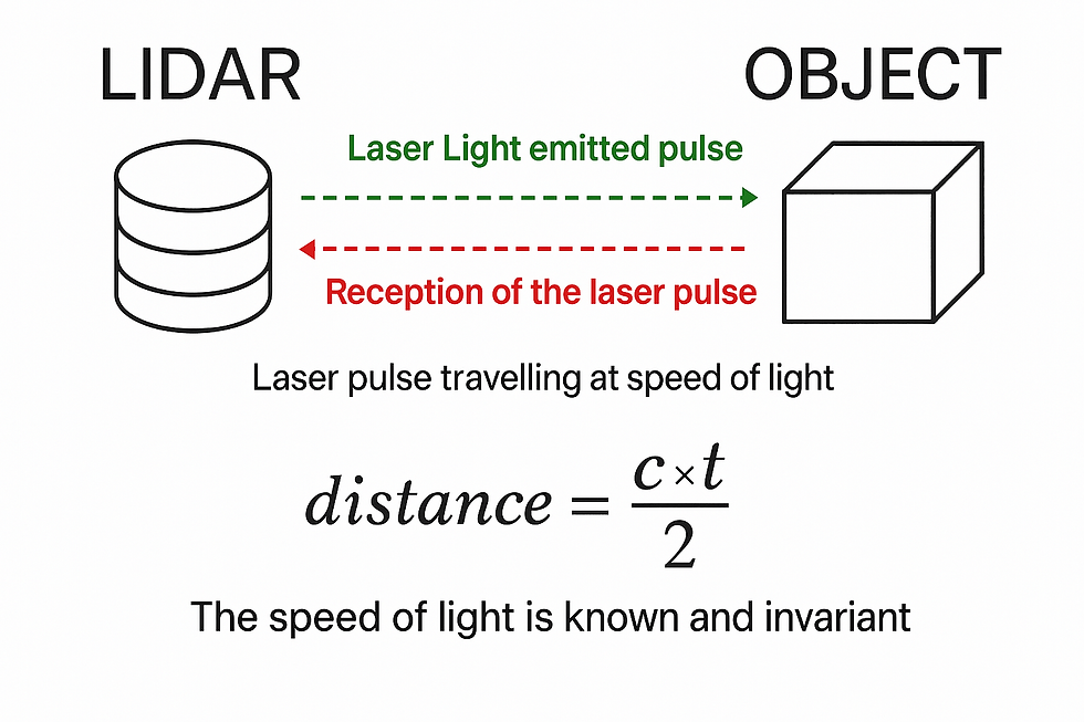
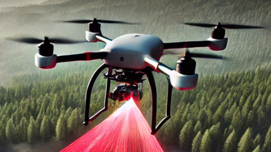
LiDAR is a remote sensing method that uses laser light to measure distances to objects. A LiDAR sensor emits laser pulses and measures the time it takes for each pulse to return after hitting a surface. Using the time-of-flight and the known speed of light, the system calculates distances.
A point cloud is a set of points in a 3D coordinate system, where each point typically has:
x coordinate
y coordinate
z coordinate
and sometimes
colour
intensity
reflectivity
other
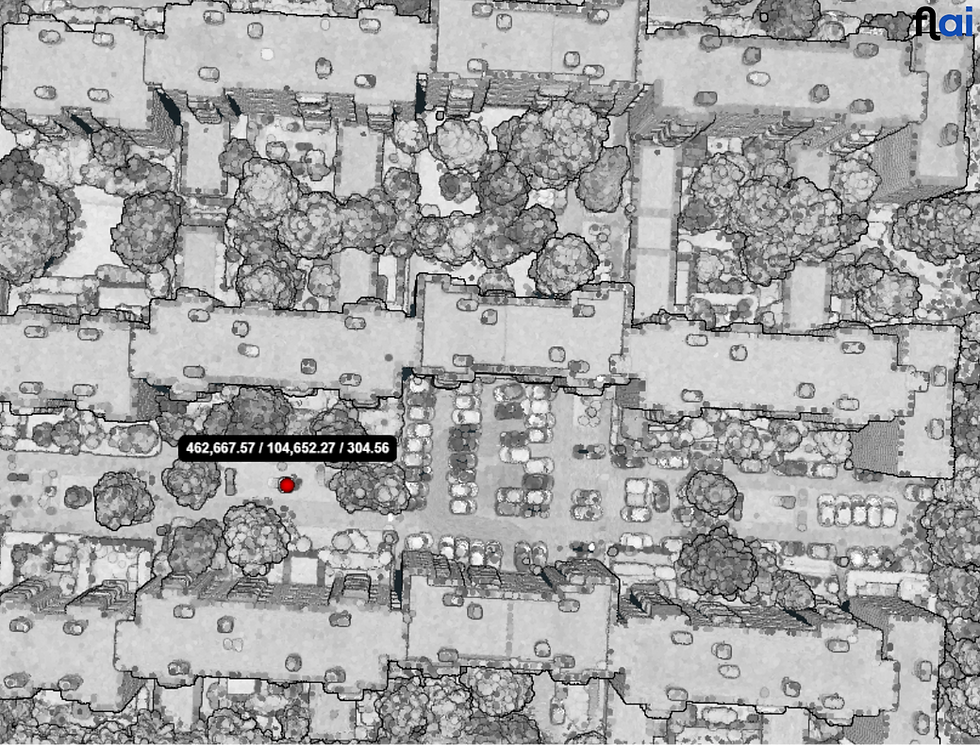
These points collectively represent the shape and surface details of an object or environment, making point clouds a fundamental data structure in 3D modeling, computer vision, and spatial analysis.
Sources of Point Clouds and Acquisition Platforms
Point clouds are generated using various methods, each suited for specific applications and environments. The accuracy, density, and completeness of the data depend on the acquisition technique and the platform used.
Point clouds can be obtained through different technologies, each offering unique advantages depending on the use case:
Laser Scanning (LiDAR)
Light Detection and Ranging (LiDAR) uses laser pulses to measure distances to objects, generating high-precision 3D point clouds.
Commonly used in autonomous driving, geospatial mapping, forestry, and construction.
Effective in low-light conditions and can penetrate vegetation to capture ground elevation.

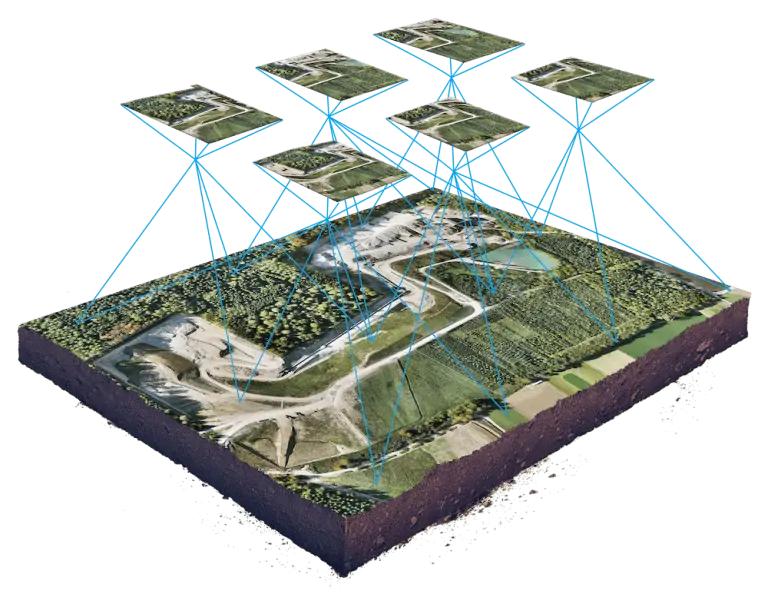
Photogrammetry
A technique that reconstructs 3D point clouds from 2D images using triangulation.
Typically used in aerial surveys, architecture, and archaeology.
Requires multiple overlapping images from different angles to create an accurate model.
More dependent on lighting conditions and image quality than LiDAR.
Bathymetry
Used to generate underwater point clouds by measuring depths and underwater terrain.
Can be achieved using sonar (acoustic waves) or LiDAR adapted for water penetration (green wavelength LiDAR).
Applied in hydrography, marine navigation, and underwater exploration.

The platform used to collect point cloud data depends on the target environment and required coverage area. The main categories include:
Aerial Platforms (Aircraft, UAVs/Drones)
Used for large-scale mapping, such as topographic surveys, forestry analysis, and disaster response.
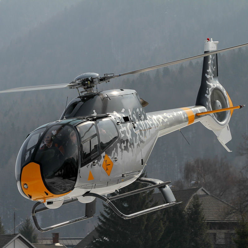
UAV-based LiDAR and photogrammetry provide high-resolution data for localized mapping. Aircraft-mounted sensors are used for regional or national-scale surveys.
Mobile Platforms (Vehicles, Trains, etc.)
Mounted on cars, trains, or boats for road mapping, urban modeling, and infrastructure monitoring.
Mobile LiDAR systems can capture street-level details, making them useful for city planning and autonomous navigation.
Terrestrial (Stationary Ground-Based Scanners)
Used in construction, cultural heritage preservation, and indoor mapping. Provides highly detailed, close-range scans of buildings, objects, and terrain. Typically tripod-mounted for static scanning, offering high accuracy but slower data collection compared to mobile systems.
File Formats for Point Clouds
Point clouds can be stored in several formats, including:
.las / .laz (compressed LAS): Common in geospatial applications.
.pcd (Point Cloud Data): Native to the PCL (Point Cloud Library).
.ply (Polygon File Format): Used in graphics and 3D modeling.
.xyz, .txt, .csv: Plain text formats, simple but large and slower to process.
💡 Tip: Use .laz for large airborne datasets to save space and loading time.
Challenges in Working with LiDAR Point Clouds
Despite their utility, LiDAR point clouds present unique challenges:
1. Large Data Sizes
Point clouds can consist of millions—or even billions—of points, requiring significant storage and computational resources to process.
2. Noise and Outliers
Point clouds often include erroneous points caused by reflective surfaces, weather conditions, or sensor limitations. Filtering and cleaning the data is essential.
3. Complexity in Interpretation
Raw point clouds are unstructured, making it challenging to extract meaningful information without specialized tools and expertise.
Processing LiDAR Point Clouds
To make point clouds usable, they undergo several processing steps:
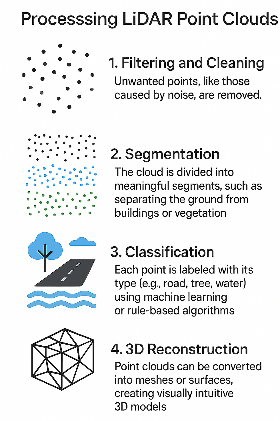
1. Filtering and Cleaning
Unwanted points, like those caused by noise, are removed.
2. Segmentation
The cloud is divided into meaningful segments, such as separating the ground from buildings or vegetation.
3. Classification
Each point is labeled with its type (e.g., road, tree, water) using machine learning or rule-based algorithms.
4. 3D Reconstruction
Point clouds can be converted into meshes or surfaces, creating visually intuitive 3D models.
Tools for LiDAR Point Cloud Analysis
Working with point clouds requires specialized software. Some popular tools include:
CloudCompare: An open-source tool for visualizing and processing point clouds.
PDAL: A powerful library for LiDAR data manipulation.
ArcGIS: Used for geospatial analysis and mapping.
Flai: automatic point cloud classification.
The Future of LiDAR and Point Clouds
The field of LiDAR is evolving rapidly, with advancements in sensor technology and data processing. Key trends to watch include:
Smaller, More Affordable Systems: Compact, cost-effective LiDAR units are making the technology accessible to more industries.
Integration with AI: Machine learning algorithms are improving the classification and interpretation of point clouds.
Real-Time Processing: Faster computational methods are enabling real-time applications, particularly in autonomous systems.
LiDAR point clouds are revolutionizing how we perceive and interact with the world. They offer an unparalleled ability to capture detailed 3D data, supporting innovations across industries. While challenges like data size and noise remain, advances in technology promise to make point clouds even more versatile and accessible.
Whether you're a researcher, engineer, or enthusiast, exploring the potential of LiDAR point clouds opens up a world of opportunities to innovate and create.
Comentarios